Vermont: The Green Mountain Gaps
Appalachian Gap (The App Gap)
Location: Vermont Route 17, Fayston, VT 05660
Elevation & Feature: 2,375 Feet · Sweeping Switchbacks & Crest Overlook
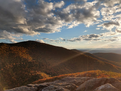
One of the most thrilling and technically challenging paved passages across the spine of the Green Mountains. Traversed via Vermont Route 17, the road features severe grades and sharp hairpins, rewarding drivers with an awesome panoramic viewing pull-off stop directly at the crest where the famous Long Trail cuts across the road.
Lincoln Gap Pass
Location: Lincoln Gap Rd, Warren, VT 05674
Elevation & Feature: 2,428 Feet · Historic Narrow Grade (Seasonal)
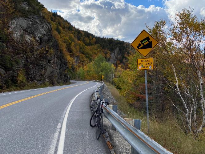
Sitting just south of the App Gap, this heavily rustic, narrow, and winding pass climbs steadily up to 2,428 feet. Combining sections of primitive dirt and packed asphalt, it contains some of the steepest paved slopes in the country. This deeply historic mountain artery is strictly closed during winter months.
Smugglers' Notch Pass
Location: VT-108, Stowe to Jeffersonville, VT 05672
Elevation & Feature: 2,162 Feet · Extremely Narrow Boulder Chute (Seasonal)
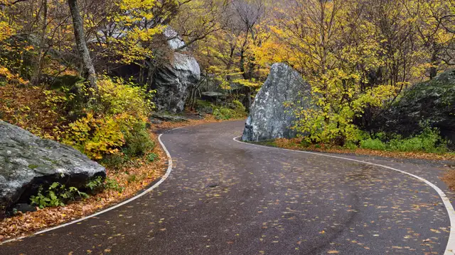
Perhaps the most famous and unusual mountain pass in New England. Cutting tightly through Mount Mansfield state forestland, the highway narrows to a single lane as it snakes directly between massive, house-sized glacial boulders. It is so tight that tour buses and large trucks are legally banned, and the pass closes entirely to all traffic once the first winter snow falls.
Brandon Gap Pass
Location: Vermont Route 73, Brandon, VT 05733
Elevation & Feature: 2,170 Feet · Sweeping Green Mountain Cliffs
A breathtaking, fully paved pass cutting straight across the Green Mountain National Forest via Route 73. Flanked by the soaring vertical cliffs of Mount Horrid, the pass offers dramatic high-altitude roadway grades and a popular trailhead parking area at the crest where travelers can access the Long Trail and panoramic rock overlooks.
New Hampshire: The White Mountain Notches
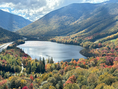
Franconia Notch (Franconia Notch State Park)
Location: Interstate 93 / Daniel Webster Hwy, Lincoln, NH 03251
Phone: (603) 823-8800
Elevation & Feature: 1,950-Foot Deep Glacial Valley Corridor
A stunning, massive glacial valley carrying the parkway directly between the soaring peaks of the Kinsman and Franconia mountain ranges. Tracing the historic trade tracks of early colonial explorers, it opens access to Echo Lake views, the Flume Gorge trailheads, and the historic White Mountain National Forest perimeter paths.
Crawford Notch (Crawford Notch State Park)
Location: 1464 US-302, Hart's Location, NH 03812
Phone: (603) 374-6000
Elevation & Feature: 1,900-Foot Rugged Cutting Gorge Pass
Carved by prehistoric meltwater floods, this grand mountain gap is beautifully traversed via U.S. Route 302. Prized for its soaring granite cliff walls and well-marked trails, the mountain pass rolls directly past iconic regional viewing landmarks, including the historic Willey House site and the Mount Washington Hotel vista points.
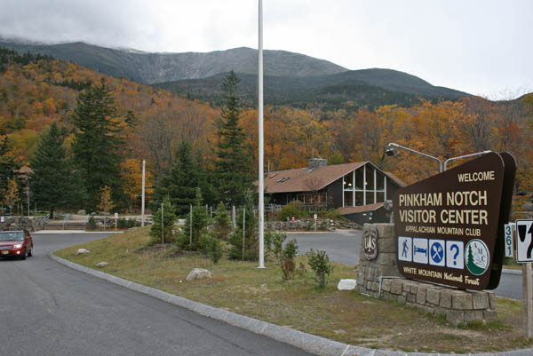
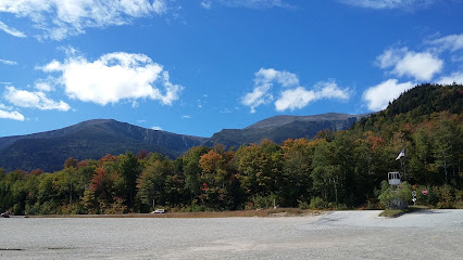
Pinkham Notch
Location: NH Route 16, Jackson, NH 03846
Elevation & Feature: 2,032 Feet · Presidential Range Gateway Corridor
Nestled directly between the soaring Presidential and Wildcat mountain ranges, this high-altitude pass on Route 16 serves as the primary base camp gateway to the highest peaks. Documented historically since 1784, it rests right at the foot of the world-famous Mount Washington Auto Road.
Maine & Scenic Highway Extensions
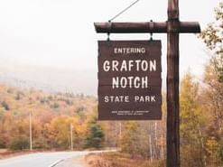
Grafton Notch (Grafton Notch State Park)
Location: 1941 Alpine Loop / ME-26, Newry, ME 04261
Phone: (207) 824-2912
Elevation & Feature: 1,600 Feet · Mahoosuc Range Wilderness Pass
Tucked into the raw wilderness of western Maine along Route 26, this gorgeous northern notch cuts directly through the dramatic Mahoosuc Range terrain. Surrounded by towering vertical stone formations like Table Rock, it offers exceptional viewing pulloffs for roadside waterfalls, pristine mountain brooks, and backcountry wildlife.
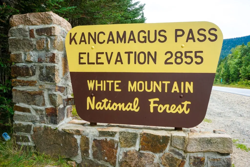
The Kancamagus National Scenic Byway Corridor
Location: NH Route 112, Conway to Lincoln, NH 03818
Elevation & Feature: 2,855 Feet (Kancamagus Pass) · Premier East-West Alpine Drive
While technically classified as a National Scenic Byway rather than a single gap, this legendary 34-mile high-altitude road climbs through the heart of the White Mountains, reaching 2,855 feet at the Kancamagus Pass crest. The route features unbeatable, clean tourist pull-offs including the Sugar Hill Scenic Vista, Rocky Gorge, and the Lower Falls rest breaks.
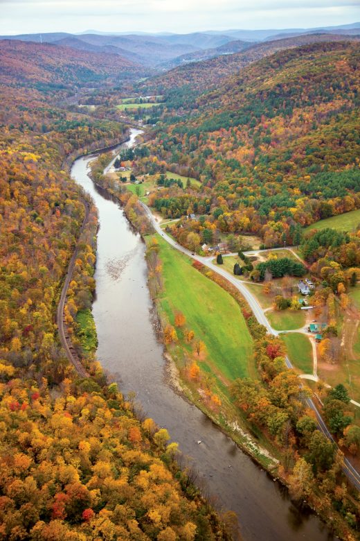
The Mohawk Trail & Dead Man's Curve
Location: State Route 2, North Adams to Charlemont, MA 01247
Elevation & Feature: 2,110 Feet (Cold River Summit) · Historic 1914 Auto Trail
Declared officially as one of the earliest designated scenic auto routes in the United States, this sweeping highway traces a historic Native American trading path across the Berkshires. The drive features the iconic "Dead Man's Curve"—a spectacular, sweeping hairpin layout that provides a dramatic, unobstructed view looking down across the entire Hoosac Valley.